 |
|
| Home Page | |
| Attractions | |
| Out & About | |
| Leisure | |
| Services | |
| Features | |
|
Holiday Planner Photographs Life in Pictures History Timeline 1890s Map Facts & Figures The Suburbs News Archive |
|
| Useful Info | |
| Links | |
Facts and Figures
Looking for population statistics or census data for Aberystwyth?
Extracts from censuses are publicly available at the Office for National Statistics website. The local electoral wards are Aberystwyth East, Aberystwyth North, Aberystwyth South and Aberystwyth West. It is also worth looking at Faenor and Llanbadarn Fawr wards, as both cover areas which are essentially inner suburbs of Aberystwyth. You can see a map of wards.
General statistics on Aberystwyth and Ceredigion county at a glance:
- The population of Aberystwyth is over 12,000 - plus around 8,000 students during term-time.
- The town is situated at the mouth of the Rheidol and Ystwyth rivers.
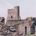
- Aberystwyth town was founded in 1277 when King Edward I issued its charter.
- Welsh Assembly Member (Ceredigion Constituency): Elin Jones, Plaid Cymru - Contact Details
- Member of Parliament (Ceredigion Constituency): Simon Thomas, Plaid Cymru - Contact Details
- MEP: Eluned Morgan (Labour) - Mid and West Wales
- Ceredigion has a population of around 70,200.
- The population of Ceredigion increased by 19.5% between 1991 and 2001.
- 51.8% of people in Ceredigion responding to the 2001 census claimed they could speak Welsh. In 1991 it was 59.1%.
- Ceredigion covers a total area of 693 square miles, giving a population density of just under 104 people per square mile.
- Over 21% of the county's population is over retirement age, while 18.1% is aged under 16. This gives Ceredigion a slightly older population than the Welsh average.
- The county has 84 schools, including 7 secondary schools.
- Agriculture accounts for 48% of business activity in the economy.